Geoalert Analytics & Mapping Platform
Get insights from Space, get Maps from pixels. Stay aware, analyse and make decisions faster with our geoanalytics platform powered by Earth Observation data and Deep Learning AI
What is Geoalert?
We perform instant, AI-powered analysis of any location in the world using satellite and aerial imagery to free data analysts from the cartographic routine and provide cartographers with powerful imagery analysis tools

Mapflow
Leverage digital mapping and analysis using our geospatial image AI-processing platform which provides ready-to-use ML models and instant access to major global satellite imagery providers.
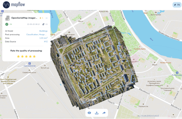
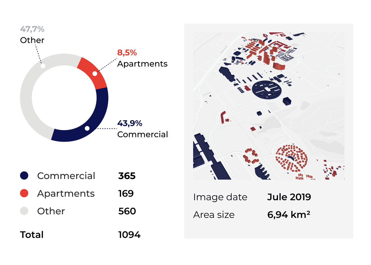
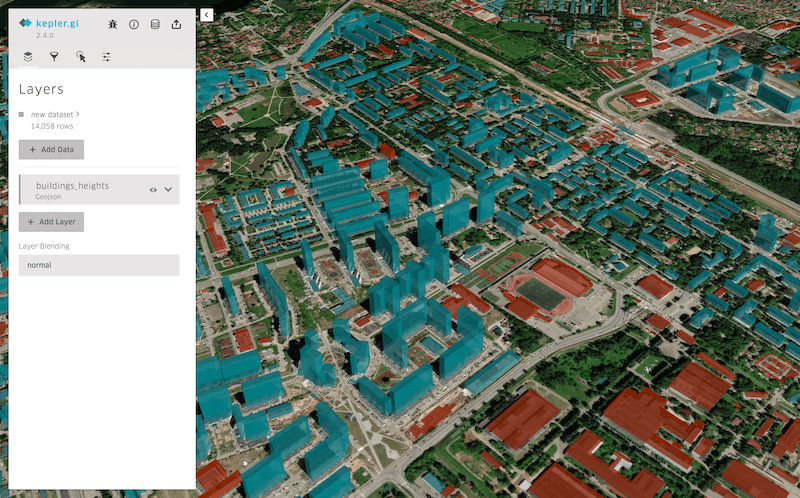
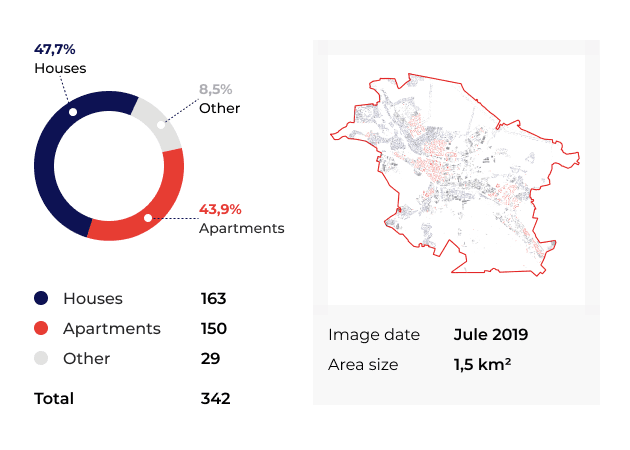
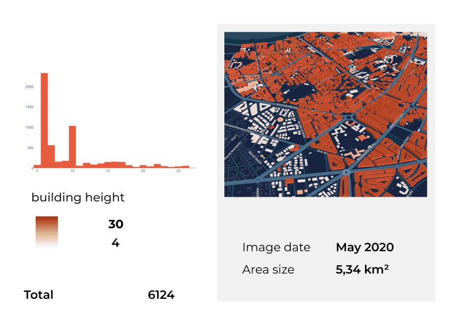
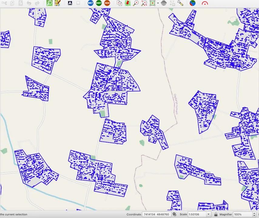
Urban Mapping
You can build a number of applications for urban management and planning - implement our data processing API or generate building footprints with heights and property types. Analyze urban patterns on a large scale.
Mapflow custom solutions
Mapflow can be applied to many cases and the most of successful implementations are done by our customers with no or little assistance by our team. Check some of the industrial cases and contact us to request the demo or discuss your project requirements.

Powerline management
Analysis of vegetation risks and work control near powerlines. Our AI models are trained on lidar data to perform on a single satellite imagery with an accuracy of F1 0.6–0.8 depending on the vegetation class and can be used in combination with other data surveys.
Telecom maps
Mapflow enables the cost-effective workflow to update 3D maps using only 2D imagery + DEM automatically. The Mapflow workflow engine is designed for large-scale imagery processing with an average speed of 1 min per 4 Megapixel (~ 1 sq. km VHR).
Among our clients and partners


From Our Blog posts
Sep 5, 2023
How to run bulk processing for feature extraction with Mapflow API
WRITTEN BY Geoalert
July 7, 2023
Segment Anything with Mapflow
WRITTEN BY Geoalert
February 26, 2023
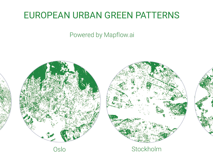
European Urban Green Patterns
WRITTEN BY Andrey Pirogov, CMO
February 09, 2023
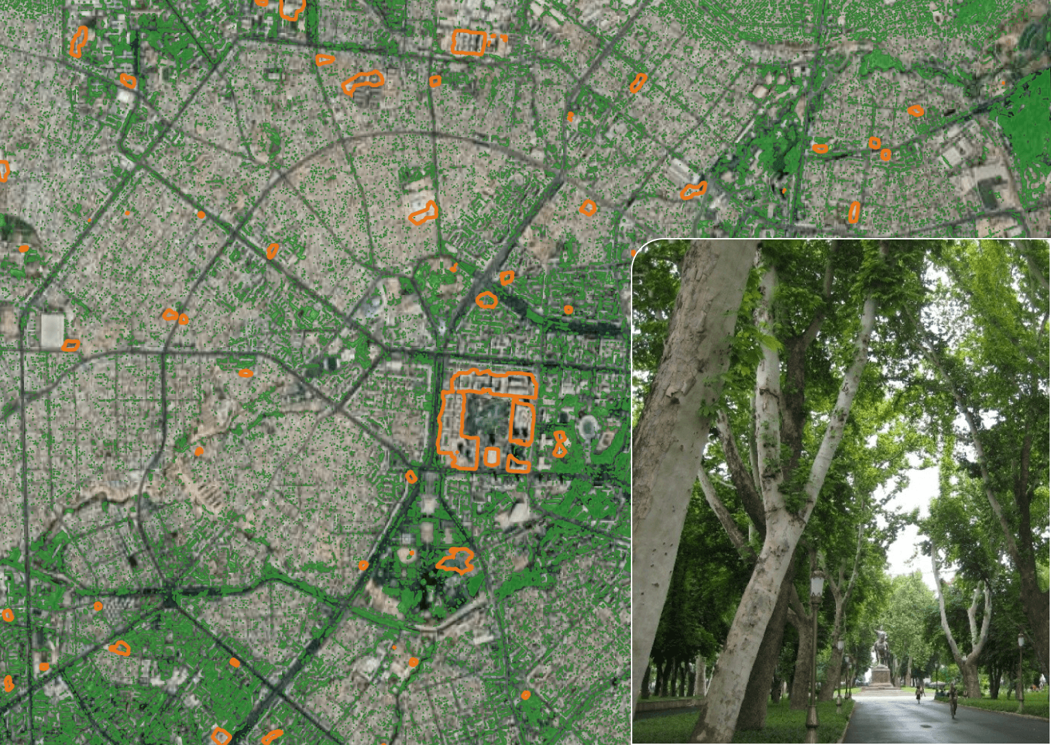
The greenest city centers in Central Asia
WRITTEN BY Andrey Pirogov, CMO
February 09, 2023
How you can use Mapflow-QGIS to leverage the search for the open data by MAXAR
WRITTEN BY Geoalert
January 09, 2023
Geoalert review 2022
WRITTEN BY Geoalert

October 26, 2022
Mapflow Academic License for students and researchers! 💥
WRITTEN BY Geoalert

August 31, 2022
Being a SaaS (Small Analytics company) in the Earth Observation market
WRITTEN BY Georgy Potapov, CEO